


GIS/Remote Sensing Application Development
Advanced GIS & Remote Sensing Solutions
GeoEDGE Platform
Our proprietary platform delivers powerful geospatial tools for analysis, mapping, and data visualization.
Custom GIS Tools
We build client-specific applications for data analysis, planning, and spatial decision-making.
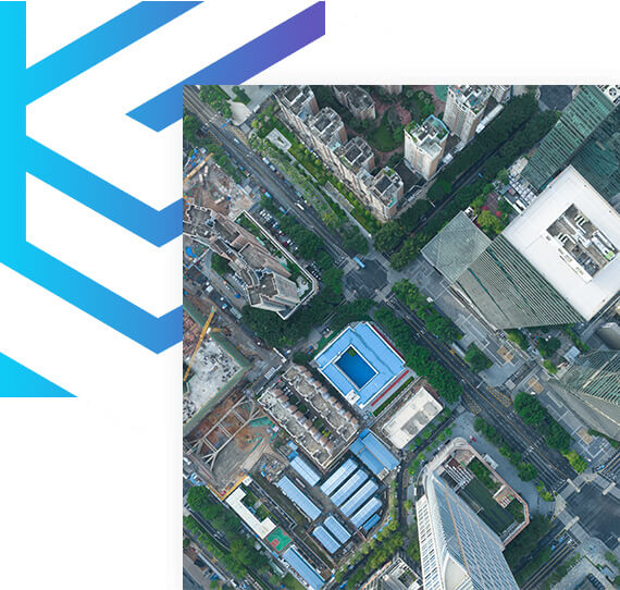
Remote Sensing Analysis
Extracting valuable insights from satellite, UAV, and drone imagery for real-world applications.
Geospatial Data Services
Acquisition, processing, and management of spatial data for multiple industry sectors.
Smarter Decisions Through Spatial Applications
- Tailored Solutions
- Imagery & Extraction
- Geodata Integration
We develop web and desktop GIS applications that match your specific workflow and sector needs. Whether it's land management, disaster response, or urban planning, our solutions enhance spatial awareness and streamline operations.
From satellite to UAV data, we offer detailed feature extraction and remote sensing analytics. Our services support vegetation indexing, land use classification, and environmental change detection with precision and clarity.
We integrate GIS tools with databases, APIs, and dashboards, creating a unified spatial system. This allows organizations to access real-time data, monitor assets, and drive decisions with location-based intelligence.
From Concept to Completion
with Precision and Care
Discover
We begin by understanding your goals, challenges, and requirements to craft a clear project roadmap.
Design
Our team creates thoughtful, user-centric designs that align with your vision and functional needs.
Develop
Using the latest technologies, we build robust, scalable solutions tailored to your specific needs.
Deliver & Support
We ensure smooth deployment and provide ongoing support to keep your systems running at their best.