GeoEDGE delivers innovative open-source solutions in software development, GIS, and remote sensing. Since 2014, we’ve empowered organizations with custom platforms that drive data-driven decisions and sustainable impact.
Gallery
Contact - United States
30 N Gould St Ste N, Sheridan, WY 82801, United State.
No 20A, Bodhiraja Mawatha, Jayanthipura, Battaramulla, Colombo, Sri Lanka
info@geoedge.net
+1(909)670-9920
PGRT
Project’s GEO Referencing Tool (PGRT)
Client:
The World Bank
Category:
GIS/MIS, Mobile App, Web Development
Client:
Oceanthemes
How it Works
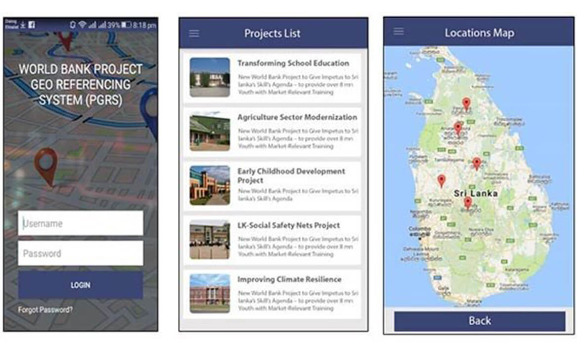
The PGRT system is a web and mobile-based solution developed to help World Bank project teams and stakeholders geo-tag project locations and attach key metadata, including photos and progress details. Built around a centralized database, the system allows for easy uploading, management, and public access to project data through a user-friendly geo portal. With interactive mapping and a searchable interface, PGRT increases transparency and engagement by enabling the public to view project footprints across Sri Lanka.
“PGRT strengthens public transparency and stakeholder coordination by transforming project data into visual, map-based insights.”
Process & Results
We collaborated with the World Bank to define a platform that supports real-time field data collection and location-based reporting. Our development team created a secure, scalable system featuring both mobile and web interfaces, equipped with intuitive tools for adding project information, GPS-tagged media uploads, and automated syncing with the central database.
The geo portal enables users—both internal teams and the public—to view project locations over a digital map of Sri Lanka, with filters for type, sector, or region. The result is a transparent, data-driven solution that promotes accountability, simplifies field data management, and supports informed decision-making for development efforts.