GeoEDGE delivers innovative open-source solutions in software development, GIS, and remote sensing. Since 2014, we’ve empowered organizations with custom platforms that drive data-driven decisions and sustainable impact.
Gallery
Contact - United States
30 N Gould St Ste N, Sheridan, WY 82801, United State.
No 20A, Bodhiraja Mawatha, Jayanthipura, Battaramulla, Colombo, Sri Lanka
info@geoedge.net
+1(909)670-9920
SASS
GMS Satellite Based Agriculture Support System (SASS) (ADB-GMS System)
Client:
Asian Development Bank (ADB)
Geo Informatics Center (GIC/AIT) -Thailand
Remote Sensing Technology Center of Japan
Category:
GIS/MIS, Web Development
How it Works
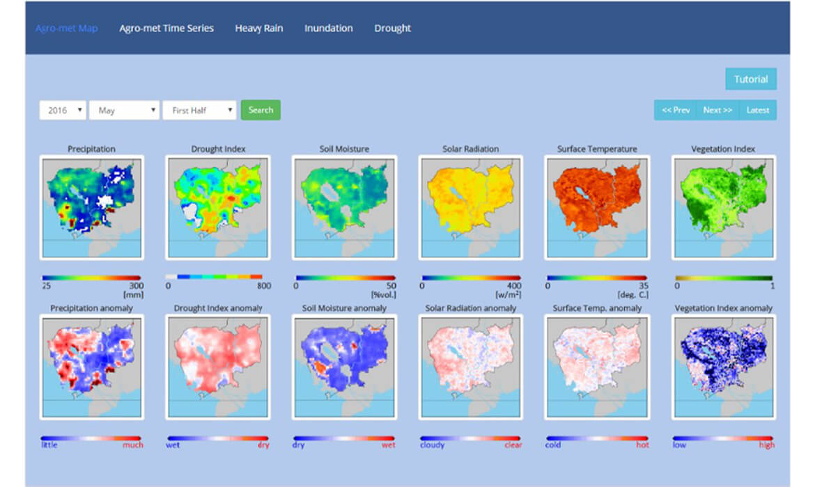
GeoEDGE collaborated with GIC/AIT and RESTEC to develop a robust web-based platform under the ADB-GMS initiative, aimed at supporting agriculture and climate resilience across the Greater Mekong Subregion. This system aggregates and visualizes satellite-derived data related to floods, droughts, crop conditions, and climate anomalies, helping local stakeholders make informed decisions.
Designed for accessibility and multilingual support, the platform integrates remote sensing data, geospatial tools, and user-friendly dashboards tailored for government agencies, farmers, and researchers in the six participating countries.
“Turning satellite data into actionable insights, SASS empowers communities across the Mekong region to respond smarter to agricultural and environmental challenges.”
Process & Results
Our team worked closely with regional stakeholders to understand the data requirements and usability goals of the SASS platform. We engineered a web-based GIS solution that consolidates satellite inputs and climate datasets into dynamic, map-based visualizations and reports. The system features intuitive tools for flood and drought monitoring, crop health assessment, and seasonal forecasting.
Throughout the development process, we prioritized multilingual design, responsive layouts, and training support to ensure adoption at both technical and community levels.
The result is a centralized, open-access platform that enhances agricultural planning, supports disaster risk management, and strengthens regional collaboration through shared data intelligence.